Frequently Asked Questions (FAQs)
Have Questions or Suggestions?
Please submit your questions/ideas in the open response text box in the project survey or by email to Senior Park Planner Mark Cleveland.
Questions and responses will be added following each milestone website posting/survey.
Survey 1 FAQ's
FAQ #1: What will the Preserve’s trails be like?
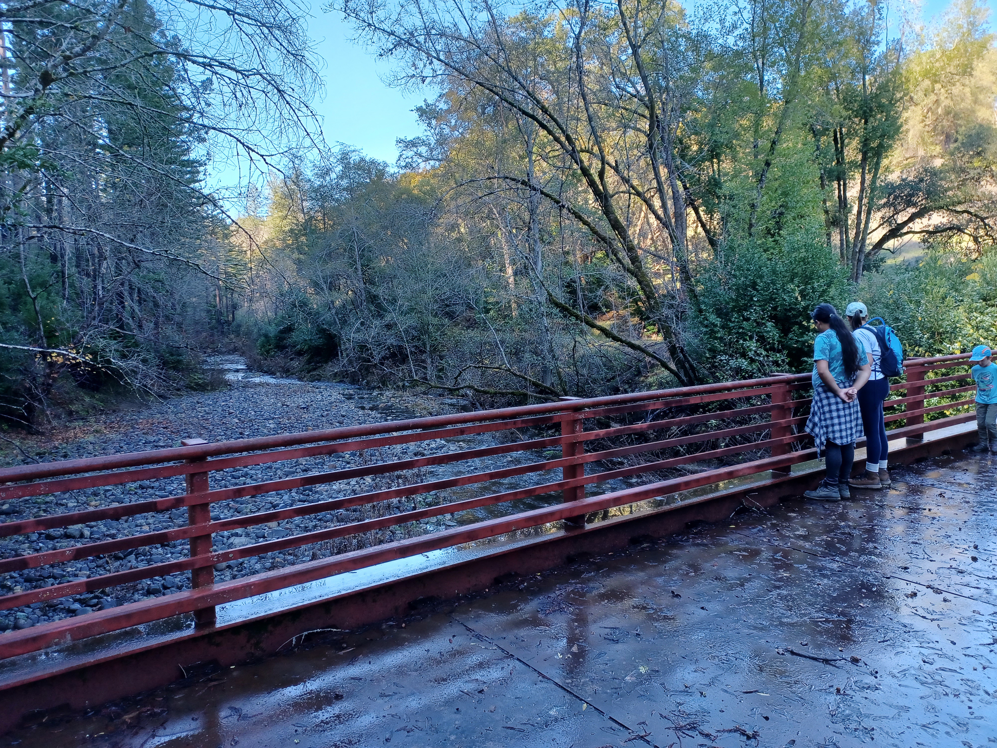
The Mark West Creek Regional Park and Open Space Preserve (Preserve) will contain a multitude of trails that provide a diverse variety of trail experiences. The trail system will include stacked loop trails so visitors can choose routes of varying distances and difficulties. Some trails will follow existing ranch roads on the property and will be as wide as 10 feet. Other trails will be narrow singletrack. All trails will be reachable via a primary trailhead at 3000 Porter Creek Road. Another trailhead on the north side of Porter Creek Road will be explored during the master plan process. Sonoma County Regional Parks will install facility and wayfinding signage along the trails, along with interpretive information on the natural resources within the Preserve. Specific trail details will be based upon public feedback received on the upcoming Web Posting 2 about project opportunities and constraints and Web Posting 3 about design alternatives. Regional Parks anticipates trail connections to surrounding public or protected lands will come in a later phase of Preserve development.
FAQ #2: Will all Preserve trails be open to dogs, horses, mountain bikes, e-bikes, and hikers?
Some trails at the Preserve will be open to all users. Others may be open to more specific combinations of equestrians, hikers, and bikers for safety reasons and natural resource preservation and protection. Whether specific trails are open to all users or a subset of user groups will depend on a number of factors including trail width, steepness, sightlines, directionality, distance from the trailhead, and natural resource protection.
Class 1 (pedal-assist) e-bikes will be allowed on all trails that allow regular bikes with a 15 miles per hour speed restriction for both.
The Master Plan will consider if and where leashed dogs will be allowed within the Preserve, or if an off-leash dog area is appropriate at the Preserve. Pending environmental review, leashed dogs may be welcome at the Preserve as at most other Sonoma County regional parks.
FAQ #3: Is Equi-Ed staying and will they have access to the Preserve?
Equi-Ed will continue to provide therapeutic programs at the Preserve under the existing lease during the master planning process. The long-term use and access will be determined as part of the planning process.
FAQ #4: What is low-intensity recreation, and how will the Preserve be designed and managed with respect to protected species, sensitive habitat, and natural systems?
Low-intensity recreation includes ways of interacting with and moving across the landscape that result in negligible impact to sensitive environmental resources like creeks and wetlands. These include hiking, biking, horseback riding, picnicking, camping, nature study, and public education. The Preserve was conveyed to Regional Parks ownership with a legally binding Conservation Easement requiring that the Master Plan prioritize the following outcomes in the following order: 1) natural resource preservation and protection; 2) scenic and open space protection; and 3) recreational and educational uses. The Master Plan will include a resource management plan (RMP) that will serve as a manual for restoring, maintaining, improving, and sustaining ecosystem diversity for future generations to enjoy. The RMP will contain special provisions for protecting sensitive habitat and species such as seasonal closures of muddy trails, invasive plant removal, sustainable forestry management, consideration of controlled burns, and repair of eroding trails.
FAQ #5: What has been done to honor and acknowledge this place as Indigenous land? Will there be any partnerships with a Native Advisory Council or Tribal leaders?
Regional Parks recognizes that the Park & Preserve is on or near the ancestral lands of the Southwestern (Kashaya) Pomo, and Coast Miwok who are the original caretakers of this area. We respectfully acknowledge the Indigenous peoples who have been stewarding and maintaining relationships on this land as knowledge keepers for millennia. Regional Parks is engaging with local Native American Tribes to gather Tribal feedback. Actions taken to honor and acknowledge this place as Indigenous land will come out of this consultation process. Regional Parks will carefully evaluate any proposed design elements for impacts to sensitive Tribal resources. In addition, Regional Parks anticipates that the Preserve’s interpretive programming will speak to Indigenous land management practices such as controlled burns. Additional ideas for honoring and acknowledging this place as Indigenous land are welcome! Please share your ideas via upcoming surveys here.
FAQ #6: How will wildfire risk be addressed, and how will the Preserve work toward climate and fire resilience?
Vegetation and fire management is crucial to maintaining the health and safety of the Preserve, nearby properties, and Sonoma County. The region is increasingly vulnerable to impacts from catastrophic wildfires, amplified by complex factors including hotter temperatures, drought, stronger winds, and a buildup of dense fuels (vegetation) from decades of fire suppression. Many plant communities in the Preserve are adapted to fire, and thrive on or even depend on small, frequent burns that characterized the centuries of Indigenous land management in the region. While the particular measures for the Resource Management Plan (RMP) are not yet selected, efforts may focus on managing fuel loads, reducing unintentional ignitions, supporting fire-adapted habitats, promoting education, designing/incorporating infrastructure to support firefighting efforts, and creating climate durable infrastructure in keeping with Regional Parks’ strategic plan. Regional Parks and its partners will develop fire-adaptive management strategies in the project’s RMP and forestry management plan later in the Master Planning process.
FAQ #7: Can I let my dog off-leash?
Pending environmental review, leashed dogs may be welcome at the Preserve as at most other Sonoma County regional parks. Unleashed dogs are only allowed at off-leash dog facilities, such as Ragle Ranch Regional Park. The Master Plan will consider if and where leashed dogs will be allowed within the Preserve, or if an off-leash dog area is appropriate at the Preserve.
FAQ #8: What other kinds of day-use activities can I expect to find in the Preserve?
We anticipate several facilities will be proposed during the master planning process based on the allowable uses included in the Conservation Easement. The Preserve currently has an established road and trail system that can provide opportunities for bicycling, horseback riding, hiking, and wildlife watching.
We anticipate picnic sites, educational programs, guided walks, and self-guided interpretive trails will also be considered during the planning process. Other amenities will depend on your feedback and could include nature-based facilities like overlooks, an interpretive center, a developed campground, and possibly a nature play area within the Primary Building Envelope. The Preserve’s Conservation Easement does not allow facilities for a developed urban recreational park (i.e., water park, skateboard park, athletic fields, disc golf, tennis courts, traditional children’s play structures, etc.). All proposed facilities will need approval as consistent with the CE for the property by Ag + Open Space.
FAQ #9: Will camping, campfires, and RVs be allowed at the Preserve?
The Preserve’s Conservation Easement allows up to 2 backcountry trail camps for primitive camping. Primitive camping provides minimal improvements for the user. They would consist of a picnic table, food locker, tent pad, and may include composting toilets and a water source if available. Other types of camping, including tent camping, RVs, and other overnight accommodations, could be accommodated within the Preserve’s Primary Building Envelope at 3000 Porter Creek Road.
Campfires will be evaluated in the community engagement, master planning, and environmental process for the different types of camping proposed and the specific conditions in which they might be appropriate.
FAQ #10: What parking facilities will be available at the Preserve?
The Preserve will have parking for a variety of vehicles–including passenger cars and vehicles with horse trailers–at the main entrance at 3000 Porter Creek Road. The Master Plan will consider public input for amenities such as EV chargers and RV spots. Like other Sonoma County Regional Parks, there will be a day-use fee for parking and those visitors holding active Regional Parks passes will not be required to pay that fee.
FAQ #11: Will there be any other park programs in the future?
Yes, Regional Parks intends to continue park programs at the Preserve within the spirit of the Conservation Easement after the Preserve officially opens to the public. The Conservation Easement allows recreational and educational special events for up to 50 people within the Primary Building Envelope and along designated trails as frequently as desired and allows for other programs and activities based on the size, location, and character of the event. The Conservation Easement allows up to 6 recreational or educational events of up to 250 people per year within the Primary Building Envelope and along designated trails, 6 daytime events per year for up to 50 people within the Picnic Area, and 12 guided nighttime or overnight programs each year for up to 50 people within the Picnic Area or along designated trails.
FAQ #12: How will safety/security be managed?
The Preserve will be open from 7am to sunset for day-use activities like other Sonoma County Regional Parks. An electronic gate currently controls access to the main trailhead area. Overnight visitors will have access to the Preserve through the automatic gate or some other means and would be assisted by a camp host. There are 3 staff residences allowed under the Conservation Easement to provide additional site safety and security. Two can be located in the Primary Building Envelope, with a 3rd located in the Secondary Building Envelope. The Preserve will be patrolled and managed by rangers, resource management, and maintenance staff. The Master Plan will include a plan for emergency evacuation to account for fires, flooding, and other potential safety events or issues.